Our Projects
-

Stakeholder, Subject matter expert workshops
Development of a bespoke online mapping application for enhanced workshop collaboration. This dynamic tool empowers users to seamlessly navigate data layers, fostering improved interpretation and decision-making.
-
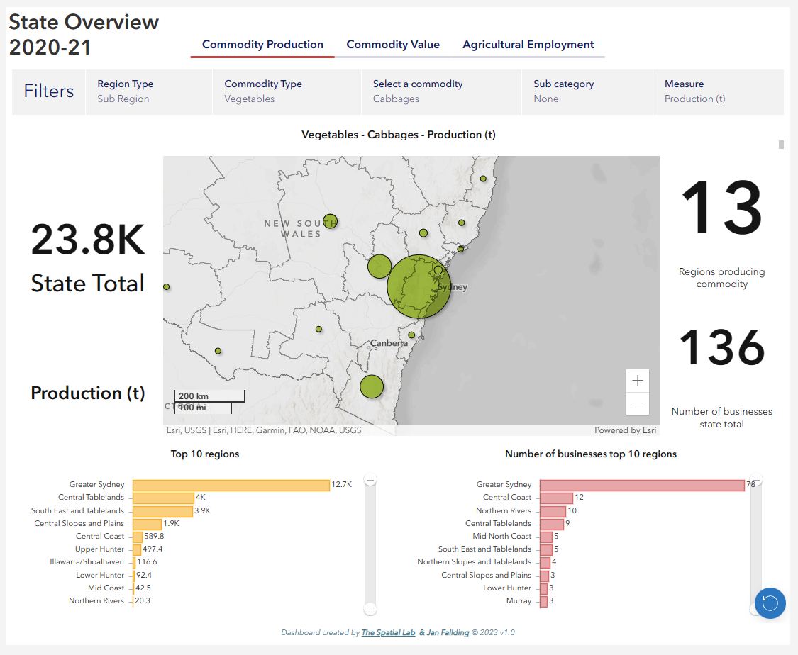
NSW Department of Primary Industries AgTrack agricultural and land use dashboard
Introducing the AgTrack Dashboard, a comprehensive tool designed to revolutionize land use planning in New South Wales.
-

Unlocking Development Potential: Constraint Analysis, Maps and Dashboards
A streamlined service to simplify the interpretation and viewing of extensive constraint data.
-

Ensuring Water Quality in the Hunter Region's Catchment Areas
Indispensable need for accurate catchment boundaries to safeguard the drinking water catchments upon which the Hunter Region relies.
-
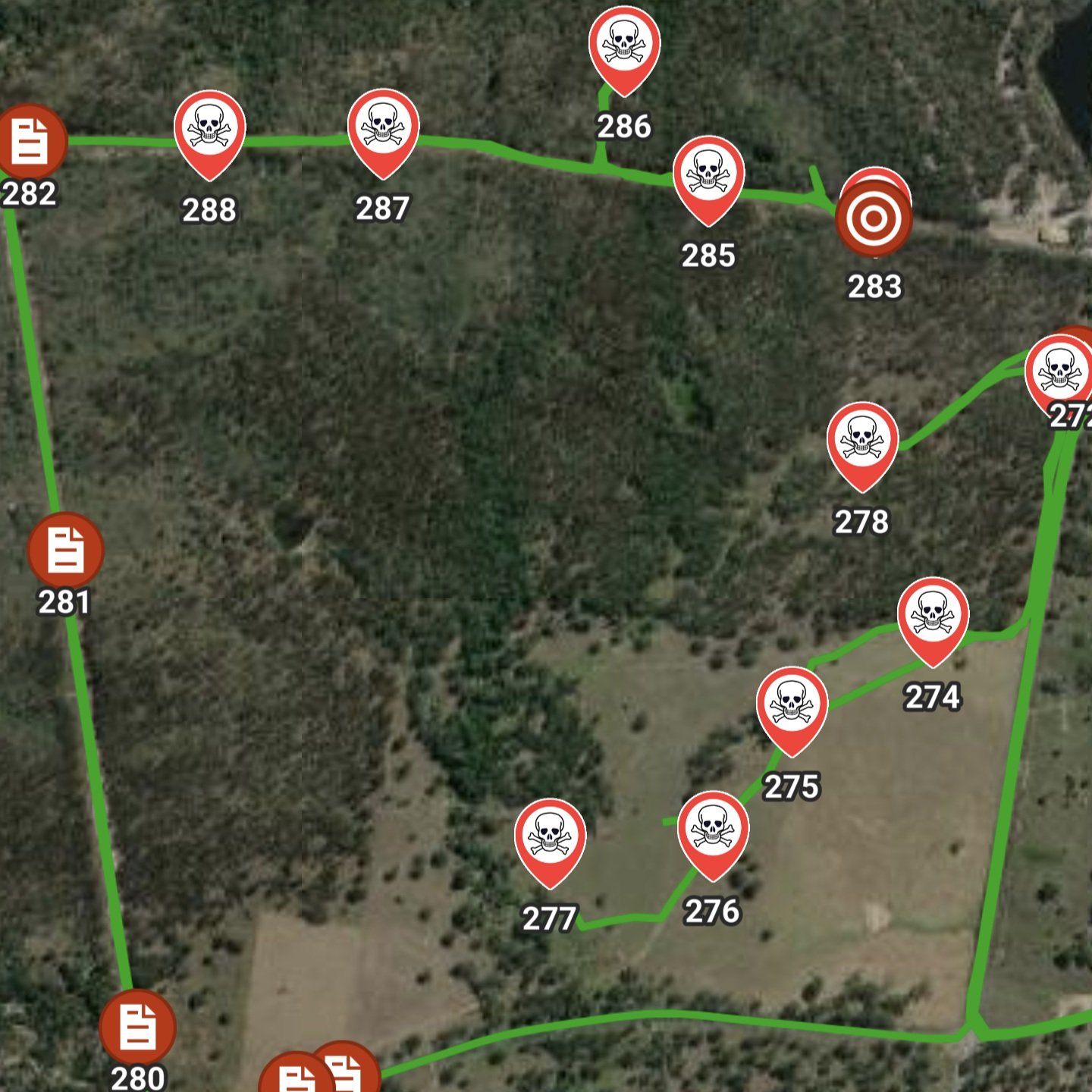
Hunter Land Management - Field & Work Apps for Weed & Pest Control
Hunter Land Management faced a challenge: How to streamline their management workload for client land holdings reporting?
-

Historic Maps of Newcastle NSW web app
Development of a web mapping application to view historic maps of Newcastle along side current aerials and properties.