Castlereagh Country Groundwater Access Toolkit
The Spatial Lab had the exciting opportunity to partner with Projence to create an interactive Groundwater Access Map for the Gilgandra and Warrumbungle Shire Councils as part of the Castlereagh Country Drought Hub.
This project has combined the groundwater expertise of Dr Andrew Krause (Projence), Greg Brereton (Water Resources Drilling) and Dr Tina Jafari with The Spatial Lab's expertise in advanced spatial analysis and interactive web mapping. Working closely with the groundwater experts, we translated their knowledge of groundwater sources, licensing requirements and bore drilling into an accessible spatial tool for landholders.
There are a range of factors to consider when choosing a site to drill a bore, and each groundwater source has different requirements under its relevant Water Sharing Plan. When developing the Castlereagh Country Regional Drought Resilience Plan, landholders reported difficulty navigating the complex groundwater licensing and approvals process, with essential information spread across multiple government websites.
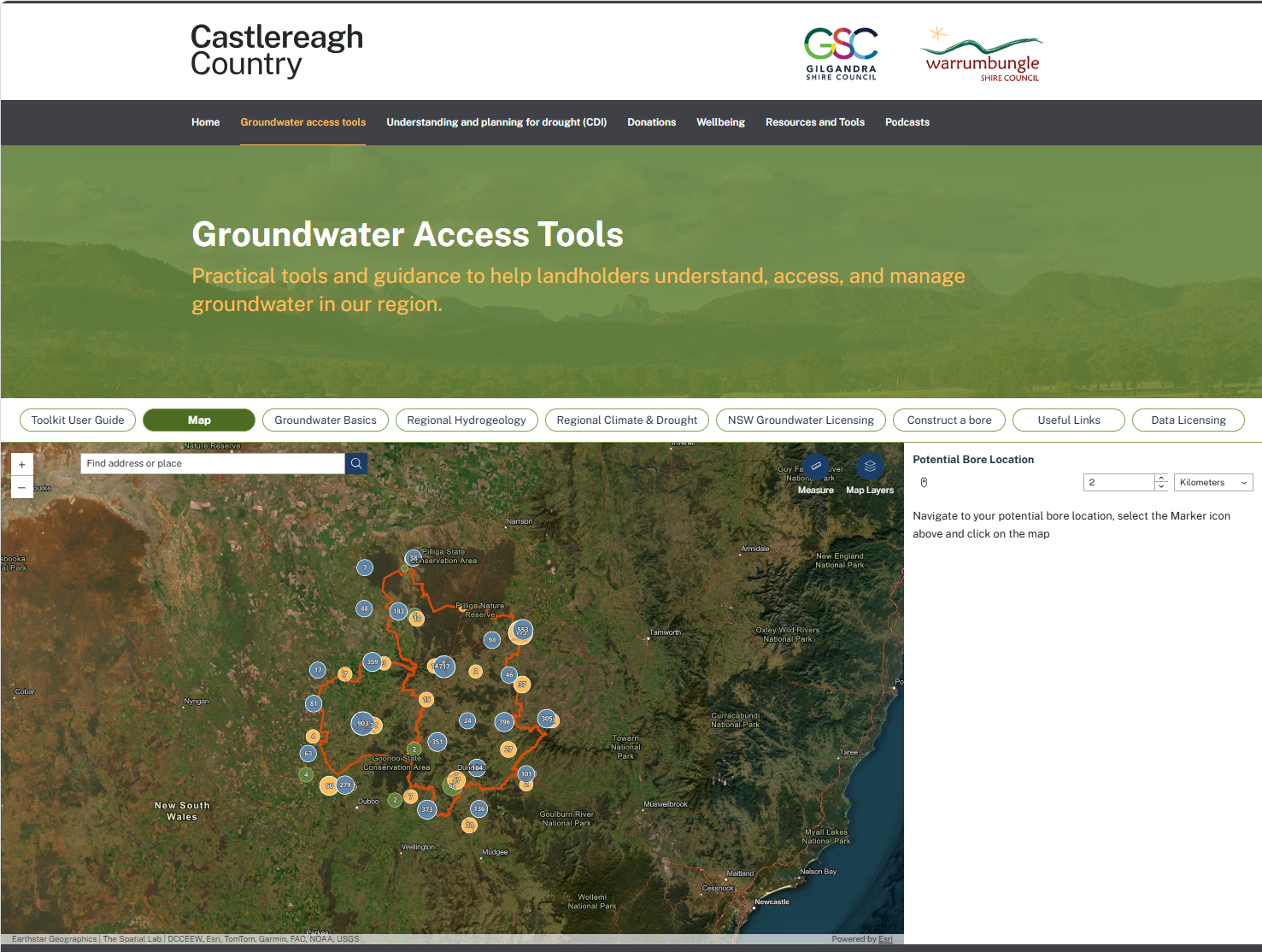
The Groundwater Access Map brings this information together in one place. Users can drop a pin at a potential bore location and view the distance to existing bores, identify potential groundwater sources at the location and access key licensing information for those sources.
Using information from WaterNSW and direction from the groundwater experts, The Spatial Lab brought together the key datasets in an interactive web map application built using Esri's Experience Builder. The map allows landholders to explore groundwater information spatially and better understand the key considerations when deciding on a location to drill a bore, supporting drought preparedness. While this map doesn't replace expert advice, it does provide landholders who are considering a groundwater bore a single starting point for discovering groundwater information relevant to their property.
Link:
Groundwater Access Tools NSW | Castlereagh Country Drought Hub
Media Releases:
Castlereagh Country Launches Groundwater Access Toolkit | Warrumbungle Shire Council
Castlereagh Country Drought Hub Launched | The Gilgandra Weekly
Services Provided:
Data Analysis | App development | Design | Cartography
Client:
Castlereagh Country
At The Spatial Lab, we turn complex information into accessible spatial tools.